SatSoil
NASA data not loaded yetSummary
ENTR

Application

  • Field overview
  • NASA data
  • Water management
  • Crop rotation
  • Digital twin
  • AgriSprayPrototype
  • Summary

Smarter farm decisions with satellite data

Draw a new field
  • Field overview
  • NASA data
  • Water management
  • Crop rotation
  • Digital twin
  • AgriSpray
  • Summary

AgriSpray module

Spray analysis

Soil readings and spray-card scans from the field, combined with real NASA Earth data, so every spraying decision is backed by evidence from your own field.
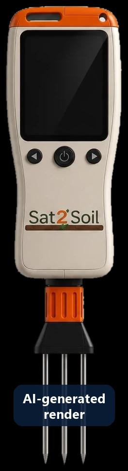
  • Measures spray coverage
  • Field data + NASA data
  • More informed spraying
Sat2Soil handheld prototype with a screen, three buttons and a three-pin soil probe

Prototype

Sat2Soil device

ESP32-S3 · macro camera · exchangeable soil probe

A handheld probe that measures soil moisture, temperature and EC at several points of the field and photographs spray cards with its macro camera.

Physical prototype built · data link in development

How the system works

  1. 1The farmer measures at several points of the field.
  2. 2The device sends soil readings and card images to the app over Bluetooth or Wi-Fi.Planned
  3. 3Field readings are combined with NASA POWER data for the same place.
  4. 4Sat2Soil produces an explainable spraying report.

Prototype · simulated data. The physical prototype exists but does not send data yet.
Every reading, map point and card on this page is an example of what the prototype will report. NASA POWER values are real.