
SAT2SOIL
From Satellite to Soil,
From Data to Decisions.
We combine NASA Earth observation data with field analysis to give you practical, explainable decision support for your fields.
 Built at NASA Space Apps Challenge 2026 · Konya
Concept animation (AI-generated)
- NASA data
- Water management
- Crop rotation
- Digital twin
- AgriSpray device
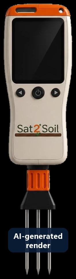 AgriSpray prototype
The satellite sees the region.
AgriSpray measures your field.
NASA data describes a grid cell about 55 km wide. The AgriSpray handheld probe adds what happens inside your own field, at the moment you spray.
- Soil moisture, temperature and EC measured at several points of your field
- Spray cards photographed and measured: coverage, stains per cm², uniformity
- One report that combines your field readings with real NASA POWER data
| NASA POWER | AgriSpray | |
|---|---|---|
| Scale | ≈55 km grid cell | Inside your field |
| Timing | Daily, 2–4 days delay | At the moment of spraying |
| What it tells you | Regional rain, temperature, wind, sunlight | Soil state and spray coverage on your crop |
Physical prototype built · data link in development · values in the demo are simulated
Intelligence from space for your field
An integrated farming tool that reaches from satellite data to the field.
 Follow your field's climate from spaceDaily NASA POWER series for your field's location: rain, temperature, humidity, wind and sunlight.
 Make better-informed decisionsCompare water needs and crop rotation plans, with every assumption spelled out.
 Build your field's digital twinTry what-if scenarios such as a dry year or another crop, kept clearly apart from observed data.
SAT2SOIL
How it works
- 1
Choose a field
Open the sample field in the Konya Plain or draw your own on satellite imagery.
- 2
See NASA data for its location
Real NASA POWER series for the grid cell around your field, with source, unit and date.
- 3
Compare plans
Water balance and crop rotation options, explained step by step.
SAT2SOIL
Data you can trust
We say exactly where each number comes from, including the sources that are not connected yet.
Satellite and model data describe a grid cell, not a point measurement inside your field.
- NASA POWERClimate and meteorologyLive
- NASA GIBS · HLSTrue-colour satellite imagery, 30 mLive
- GPM IMERGPrecipitationPlanned
- Landsat / HLS NDVIVegetation index (NDVI)Planned
- SMAPSoil moisturePlanned
- AgriSpray deviceField measurementsPrototype · simulated data